Overview
I began planning for this trip at least a couple of years before returning to the States in 2015.
Actually, I should say that I began praying about this trip back then. When I finished Combination Trip 2010, I was not sure if I would ever make another such trip in my life. It wasn't that I was disillusioned with camping or the outdoors or anything like that. Rather, I sensed that I had been making plans without praying about it and seeing if it was God's will. When I mentioned this to others, many sort of scoffed and said, “well, of course it would be alright for you to take a vacation trip when you're on furlough!” Still, I wasn't satisfied with such a simplistic reply. Maybe it was God's will, but I wanted to be sure. For all I knew, He had something else in mind.
Nevertheless, a couple of years ago I started planning. I figured that, if it was His will—and up to that point I had not sensed that it wasn't—I should at least start figuring out where I would go and what I would do. And as the final year of my last field term rolled around, I found myself facing some other questions that I seriously needed to pray about.
And I began to sense that I needed a time like I usually had during my camping trips to get away and pray about them.
Thus was born Spiritual Journey 2015.
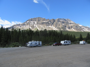
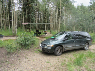
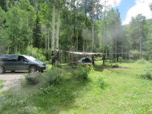
Even before starting out, I decided that it would be a good idea to apply all the lessons I had learned during previous trips, and try to be truly prepared. Experience had shown that I cannot trust the weather to cooperate. I have also learned that old beater cars may save a few bucks at the beginning, but they usually end up costing time and money while traveling. So I decided, one way or another, that I was going to either buy or otherwise obtain the use of a better, more reliable vehicle this time. I also made a list of equipment that I wanted to take, making sure that it was in decent shape. A good tent, instead of one that leaks. A well-researched list of campgrounds, broken down by state. A good camera. A tarp to shelter the picnic table. And so forth.
I had basically arranged to rent a vehicle through an organization that provides furlough vehicles for members of organizations such as Wycliffe, when my sister offered me the use of one of hers. They have several cars, and decided that they wouldn't miss one, as long as I would take good care of it. So after I returned to the States in April I ended up choosing to use the 2000 Chrysler Town and Country mini-van. And while I was there, I finished the campground research that I had already started back in Brazil, and got the equipment I wanted. In addition, I built a shelf for the van that connected to the same rods that were used for the rear seats, so that I did not have to do any drilling or other damage to the vehicle.
Before this trip, I made a “trial run” trip, down to see friends in North Carolina and Indiana, as well as visit Great Smoky Mountain National Park. That trip is not included in this report. But in addition to allowing me to reconnect with some people and see the Smokies, it served as a “shakedown cruise” for the car and equipment.
This trip can basically be broken down into two halves: Before the Fourth of July weekend, and after. Before, I was on a schedule; people were expecting me at the beginning of the trip, and on the Fourth. So while I was able to “flex” my travel destinations between these dates, there were constraints. Also, I was pretty busy sightseeing in national parks, both in the States and Canada. And after the Fourth, I visited Yellowstone and Rocky Mountain Parks. It wasn't until after Rocky Mountain that I went into the “relax around the campground” mode. It was then that I was able to really begin to bring the questions that I wanted to pray about before the LORD.
Was it worth it? Did I get any answers? Well, I didn't get the kind of answer that I had expected. On the other hand, by the time I got to Tucson, it was pretty clear what God was saying. Some specific questions remain unanswered, because He made it clear that I needed to deal with other issues first. Get the garbage out of the way, then look for the treasure; that sort of thing.
And so here it is. As I mentioned, I got a decent camera (Canon PowerShot SX610 HS), with a 32GB memory card, so I could take a lot of shots. I've included (shrunken versions of) quite a few of those pictures in this report. I've also tried to describe my journey in at least moderate detail.
So I hope you enjoy this account of a trip through God's handiwork.
June 5 - 10: Minnesota
Wildernet – Minnesota
Explore Minnesota
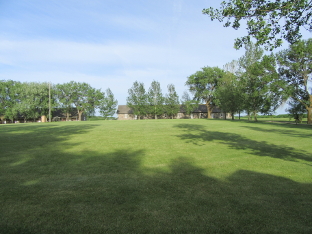
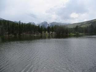
I actually started this journey in Wisconsin, after spending a month and a half with family following my return from Brazil. But my first stop was in Minnesota, to visit my friends Jim and Julie, who were staying in a county park near Madison Lake. I arrived at Bray Park in the middle of the afternoon, and stayed for 3 nights. During that time we renewed acquaintances, did some sightseeing, and basically relaxed.
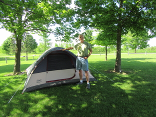
Billiard and Tent at Bray Park
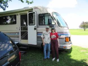
Jim & Julie and Motorhome
I left on Monday, June 8, to visit another couple that I had worked with for years in Brazil. Dan & Cheryl had been colleagues in Brasília, Cuiabá, and Anápolis. Originally from Minnesota (well, at least Dan was), they have retired to McIntosh. McIntosh was an easy, less-than-day drive up from Madison Lake, and I arrived in the afternoon.
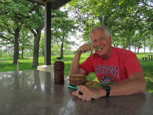
Eating Lunch at Rest Area on Way to McIntosh
I had visited Dan and Cheryl in McIntosh back during Rocky Mountain High '05, while they still worked with SIL in Brazil and were home on furlough. However, this time they lived in town instead of out in the country, and their son Andy was no longer at home, so we did not go out gopher hunting. However, we did do some bike riding, and I took some walks around the town.
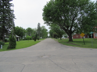
Residential Area in McIntosh
I had originally planned on only staying a couple of days. However, my schedule allowed for some flexibility, and I ended up staying for a third night. Then on Thursday morning, June 11, I left to continue my journey, heading to South Dakota.
June 11 - 12: South Dakota
Wildernet - South Dakota
South Dakota Tourism
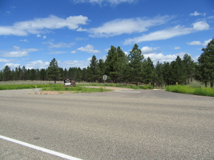
I actually passed briefly through North Dakota, originally planning to stop for groceries. However, I was unable to find the WalMart that I was looking for, and since I actually had enough for another day, I decided to put the shopping trip off. As a result, I arrived at Fort Sisseton State Park late in the afternoon. Upon arrival, I discovered that reservations were necessary—however, they kindly provided a phone number and I was able to call from my cell phone at the gate and get one! Although Fort Sisseton was an interesting historical place, my main purpose was just to find a place to sleep.
Historic Fort Sisseton Quadrangle
The following morning, I left Fort Sisseton and took the back roads to Aberdeen, where I found a WalMart and stocked up. I found it very interesting that here was another Aberdeen on US 12! I have also visited Aberdeen, WA—which is also on US 12, but at its western terminus.
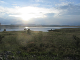
After shopping, I continued down to I-90, then went west to Badlands National Park. Now, every other time I've been to Badlands, I have always either just “passed through,” or stayed at Cedar Pass Campground. Since the Feds keep jacking the cost of camping up all over the country, and I still haven't reached the magic age of 62 when I will qualify for a senior discount, I decided to do something different and stay at the (free!) Sage Creek Campground.
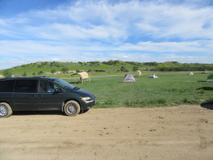
Campsite at Sage Creek Campground
I had originally planned on staying 2 nights in Badlands. However, I was a day behind schedule, because of staying an extra day in Minnesota. And there really weren't any trails near Sage Creek. And everything was heavily sopped because it had poured bats, frogs and wiener dogs the day before I got there. So I ended up only spending one night. The next day I packed up and headed over to Wyoming.
June 13: Wyoming
Wildernet – Wyoming
State of Wyoming
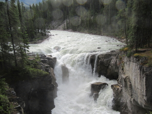
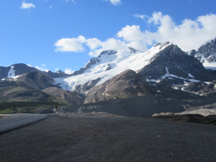
This was my first visit to Wyoming during this trip. I would be back later, after the 4th of July. This time, I merely passed through the northeast corner of the state. But during that brief passage, I spent an afternoon and night at Devil's Tower National Monument.
I had been here before, and while I never cared much for the name, the place is definitely worth visiting. During National Parks Tour '04, I stopped during the day just long enough to hike the Tower Trail, a short trail that just goes around the base of the Tower itself. During Combination Trip 2010, I had a picnic at Belle Fourche, then spent a couple of hours doing the Joyner Ridge Trail. This time, I pitched my tent at the Belle Fourche Campground, then went to the Visitor Center and hiked the Red Beds Trail, which is the longest of all the trails at the Monument. It was a great way to spend an afternoon.
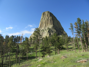
Sunlit View of Tower from Red Beds Trail
View of Red Beds and Entrance in Distance
That night, I woke up and at first thought the constant flickering light was my neighbor's campfire. It wasn't. It was a tremendous lightning storm that brought winds that nearly collapsed the tent on top of me. In the morning, I wondered how I would be able to dry it off to put it away. Fortunately, those same winds—which had let up but not quit—did a very nice job, and after a brief hike in the morning to see the Prairie Dog Town, I was able to pack up and head for Montana.
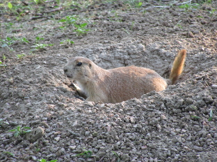
Prairie Dog Barking its Head Off
June 14 - 20: Montana
Wildernet – Montana
Montana's Official State Website
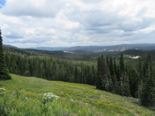
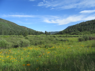
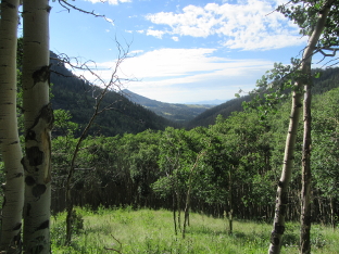
There is a campground right off of US 212 in the Custer National Forest called Red Shale, which provides a convenient place to stop. This was my fourth visit, and just like during Combination Trip 2010, I only stayed one night.
Entrance to Red Shale Campground on US 212
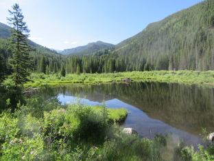
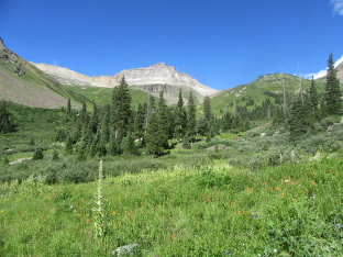
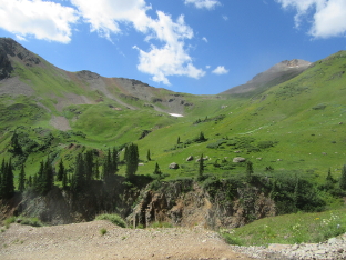
The next day, after stopping in Billings, I moved on to Crystal Lake Campground in the Lewis and Clark National Forest.
A couple of years ago, when I made my first tentative plans for this trip, I was looking at possible places to camp in this region. While looking, I came upon a page describing Crystal Lake, along with a satellite photo. I took one look (I've gotten pretty good at figuring out “ground truth” from satellite photos), and said, “gotta go there!” Then, when I was finalizing my travel plans in May, I discovered that the campground would not open until around June 15. I was planning on arriving on that date. Question: Would it really be open? I took down the phone number for the nearest Forest Service district office, and the day I left Red Shale I called them. I was gratified to find that yes, it was indeed open.
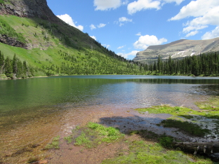
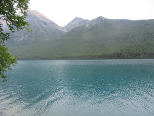
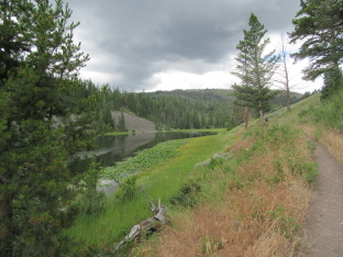
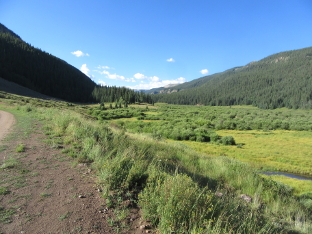
View from Crystal Lake Campground
The campground itself lies just past Crystal Lake, in deep forest. There are a few hiking trails in the area, including a loop trail that goes around the lake. Unfortunately, due to high water, the ford across the lake exit was under water, and I had to do the loop as two separate trails in order to avoid getting my feet wet.
View along Crystal Lake from South End
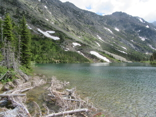
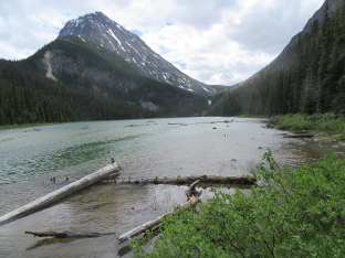
After spending 3 days at Crystal Lake—and thus fulfilling one dream I'd had for years—I then left For Cut Bank Campground in Glacier National Park, in order to fulfill another.
During Combination Trip 2010, I spent a couple of days at Cut Bank, and hiked a ways up the Pitamakan Pass Trail. I went as far as the trail division before turning back. Afterward, I looked at satellite views of the area, and realized that there was a wonderful-looking lake further up the trail if I took the left fork. (There are also plenty of wonderful places along the right fork, but I was on a schedule and needed to choose one or another.) So I had been planning to return to Cut Bank for the past few years, in order to hike the trail again and get all the way to Morning Star Lake. This time I did it.
Billiard Hiking on Pitamakan Pass Trail
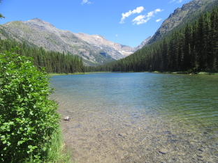
Morning Star Lake from Southeast Corner
On my final day at Cut Bank, I went up to the East Entrance. I had planned on visiting some other old favorites, such as St. Mary's Lake and Sunrift Gorge. Unfortunately, it turned out that everything was closed in the eastern part of the Going To The Sun Road. There had been recent road construction, and for some reason they had not re-opened sites for visitors. Discouraged, I went north to Many Glacier. Following a picnic lunch, I took a hike around Swiftcurrent Lake.
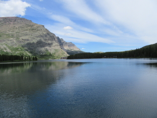
Swiftcurrent Lake from Eastern Shore
Afterward, I did a little more sightseeing, then drove back to Cut Bank to spend the night. The next morning I drove north and entered Canada.
June 21 - 26: Alberta
Explore Alberta
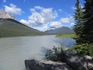
I had been in Canada several times before, but this was my first time in the province of Alberta. There are a number of great Canadian national parks on the west side of this province, and in the neighboring province of British Columbia. The first park I visited was the one right across the border from Glacier, which was Waterton Lakes National Park.
The very first thing I did, after clearing customs, was to find a place to camp at the Belly River Campground in Waterton Lakes. Belly River is right on the main highway, so it made it easy to continue my journey north the next day. Since I had only driven a short distance to get across the border, I still had most of the day ahead of me. I proceeded to enter the main part of the Park, and went to Waterton Village.
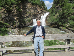
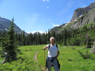
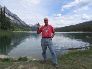
Billiard in front of Cameron Falls in Waterton Village
Waterton Village is actually a small town, geared toward tourists visiting the Park. In addition to stores, picnic areas and more, there are some trailheads. One friend, when he found out that I was planning to visit Waterton Lakes, recommended that I hike up to Bertha Lake. The trailhead was at Waterton Village, so I took this trail. Although the second half of the trail was quite steep, the view was definitely worth it when I got up to the Lake.
Bertha Lake seen from near Outflow
By the time I got back down, it was getting late in the afternoon. So I headed out of the Village, did some more sightseeing along the way, and arrived at Belly River to spend the night. The next morning I headed north to Banff.
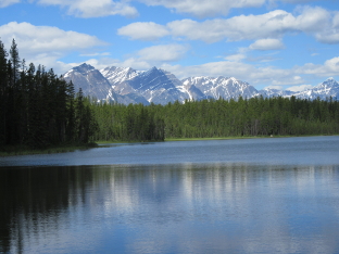
Banff National Park is one of the crown jewels of the Canadian national park system. Located west of Calgary, on the border of British Columbia, Banff is famous for its mountains and lakes. In fact, Banff was the first national park in Canada, and today continues to be heavily visited by people from all over the world.
I arrived around noon and bought five days worth of entry into Canada's national parks. I then headed up the Bow Valley Parkway to Castle Mountain Campground, where I took a site for two nights. After setting up, I had “lupper” (lunch + supper). By the time I finished and washed up, it was already getting late in the afternoon. But I headed out anyway!
I went down to the town of Lake Louise Village. I was needing things such as cash, a shower, laundry and an Internet connection. Since it was already late, the place with Internet was already closed, and I did not want to spend two hours doing laundry. Cash was unavailable in town (there were a couple of ATMs, but they all rejected my card). I went out to the shower place, but there was a huge line of traffic that was not moving. So I gave up and headed back toward the campground. Fortunately, being far north, and not long after the longest day of the year, I still had plenty of daylight to take pictures in.
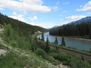
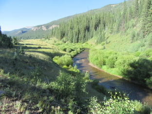
River and Railroad Track in Bow Valley
As I said, there was no place in Lake Louise where I could get cash. So the next morning I drove back south to the town of Banff and found a bank. Afterward, I returned to Lake Louise and drove up to the lake itself. Afterward, since it was nearby, I drove over to Moraine Lake.
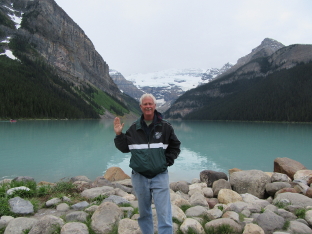
Billiard in Front of Lake Louise
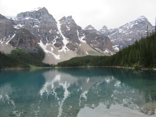
East End of Moraine Lake
By this time it was past noon, so I found a nearby picnic area and had lunch. Afterward, I returned to Lake Louise Village and did all of the “unfortunate necessities” that I had wanted to do the day before: Internet, laundry and shower. By the time I finished, evening was arriving. The places I still wanted to see were a few dozen kilometers north. I was already planning to stop at a different campground—one up north—after visiting Jasper, so I decided to return to the campground and call it a day.
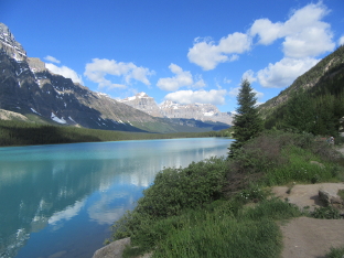
Fewer people have heard of Jasper National Park than have heard of Banff. Yet one Canadian colleague in Brazil told me that it is actually the better of the two! Given the short amount of time that I was in both, I can neither confirm nor deny. Yet I enjoyed both.
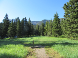
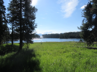
Even though I left Castle Mountain fairly early, it was a couple of hundred kilometers to get to Honeymoon Lake Campground, where I stayed while in Jasper. As the name implies, this campground is situated on the shore of a lake, even though the actual sites are in the woods. I arrived in time to set up camp and then make lunch, then wander around the campground a bit and take some pictures.
View of Honeymoon Lake behind Campground
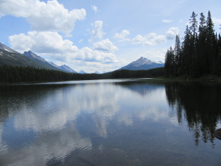
After snapping a few shots at the campground, I headed north to the town of Jasper. After picking up a couple of items at a local grocery store, and getting some park information, I headed northeast out of town to the Maligne Lake Road. Along that road I encountered a small traffic jam where a couple of bear cubs were insisting on playing in the road—and everyone was stopping to look. Continuing on, I came to Medicine Lake, and finally to Maligne Lake itself. Since it was already getting late in the afternoon, and since there was a picnic area right at the parking lot at Maligne Lake, I went ahead and had supper.
Billiard at North End of Medicine Lake
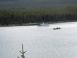
Tour Boat on Maligne Lake
After supper, I went back down the road to the town of Jasper, then back south toward Honeymoon Lake. Again, being up north and close to the longest day of the year, there was still plenty of sunlight even after 8:00 PM. So I stopped at Athabasca Falls.
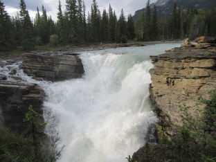
View of Athabasca Falls
The next morning, I continued the waterfall theme by going to Sunwapta Falls. Here, there was a trail which went around a kilometer from the upper falls to the lower falls. After the lower falls the trail sort of petered out along the river bank.
Upper Sunwapta Falls from Observation Point
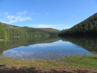
After leaving Sunwapta Falls, I hiked a short trail that led to a couple of small lakes, Buck Lake and Osprey Lake.
Osprey Lake and Mountains in Background
I liked the above picture so much that I ended up making it the background wallpaper on my computer!
Noon was approaching, so I sought out a picnic area and had lunch. Afterward, feeling up to more of a “real” hike, I went to the Geraldine Lakes Trailhead. There are two lakes, Lower Lake Geraldine and Upper Lake Geraldine. The first is only a couple of kilometers up the trail, and the other one several kilometers beyond. While hiking toward Lower Geraldine Lake, I met a couple returning, who told me that past that lake, the trail was totally muddy and soaked and impassable, unless you were wearing hip-waders. So I went as far as Lower Lake Geraldine, saw where the trail turned into a muddy morass, took some pictures, and returned.
View of Lower Lake Geraldine from near Outlet
I spent the rest of the afternoon exploring the Icefields Parkway in the region near Honeymoon Lake
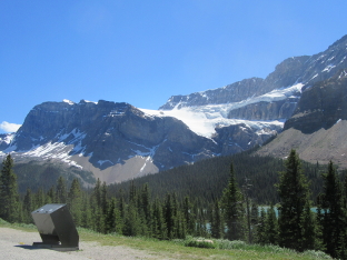
The next morning I returned to Banff, heading south along the Icefields Parkway. I was aiming for Mosquito Creek Campground (which in spite of its name is not swarming with the nasty little bugs), but figuring that I would probably have some time before the campground filled up, I stopped several times along the way to take some pictures.
View South near Beauty Creek
View of Mountain with Glacier
Shortly after this picture I crossed back into Banff. But the Icefield Parkway continued for quite a few more kilometers.
View North along River Flats
View of Waterfowl Lake looking North
Mountains and Glacier Seen from Helen Lake Trailhead
After this I arrived at Mosquoto Creek Campground and got a site. There were actually fewer sites available than I had thought, but it was not completely full. (Later on it did fill up, and a German couple asked if they could park their trailer in front of my car. I had no problem with that, but the campground hosts did. Fortunately, they were able to direct these people to an overflow area, and they were able to stay the night.)
View of Mountains from Mosquito Creek Campground
Again, there was still time left in the long afternoon, and once I was set up at Mosquito Creek and had eaten lunch, I headed out to see some nearby sights.
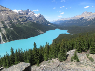
View of Peyto Lake from Side Trail
The following morning it was time to return to the States. My park entry pass expired that afternoon. Looking back, I decided that if I were ever to return to this part of the world again, I would not stay for merely 5-6 days. Instead, I would come up for at least a couple of weeks and get a park pass for at least that long. In addition to Banff and Jasper Parks, there are several others in the region. On my way back I was only able to pass through one of them, Kootenay National Park, and since it was a long way back to Montana and I needed to find a campsite that night, I did not have time to stop.
But it had been a good visit to our northern neighbors.
June 27 - 30: Montana
Wildernet – Montana
Montana's Official State Website
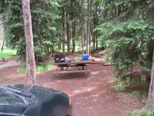
This, of course, was my second visit to Montana during this trip. This was also the first time that I visited the two sides of Glacier in independent visits, without crossing over on the Going To The Sun Road. Of course, since I was arriving late in the day, I did not even try to make it to a campground in Glacier itself. Instead, I traveled 28 miles over mostly dirt and gravel roads to Big Therriault Lake Campground, in the Kootenai National Forest.
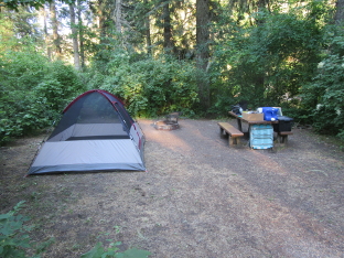
Making Dinner at Campsite at Big Therriault Lake
I originally planned to only spend one night before moving on to Glacier. However, given the distance I had traveled over rough roads, I decided to make it “worth my while” by staying an extra night. Since I was still scheduled to arrive in Boise on July 3rd, I would make it up by only staying 2 nights at a campground in Idaho.
This decision paid off in spades. On the second day, I ran into a camping neighbor who had some maps, and while talking, mentioned where I was going. I had originally planned to go back out the way I came, then down US 93 and over to the West Entrance to Glacier, then up to another entrance that would take me to Bowman Lake. This neighbor pointed out that the road I had taken for half the way to Big Therriault Lake before turning off continued over to this same road, very near the entrance I was aiming for. And furthermore, the Forest Service had assured him that it was in good condition. So when I left the next day, I followed his advice and took that road. It was definitely passable, even for a van, and thus I saved a few hours and quite a few miles of travel, arriving at Bowman Lake Campground well before noon.
Bowman Lake as Seen from Campground
I spent two nights at Bowman Lake. The first afternoon, I hiked along a trail that follows the north shore of the lake. The trail actually goes much further than I could get in one afternoon, so I went as far as a rocky outcropping where I could get a good view across the lake, then turned back.
Bowman Lake from Rocky Outcropping along Trail
The next day I packed a picnic lunch and hiked up the Akokala Lake Trail. This was a hike similar to the one up to Morning Star Lake on the east side of the Park, though not as picturesque, because of burned forest along the way.
Akokala Lake Seen from Near Outlet
The next day, I packed up, stopped in West Glacier to buy a T-shirt and get a shower, then headed down to Idaho.
July 1 - 8: Idaho
Wildernet - Idaho
Official Idaho Vacation and Travel Planning Guide
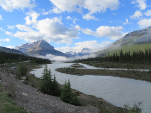
The only times I'd been in Idaho before, I had either passed through the “chimney”, or else cut through the corner of Yellowstone Park that lies in the state. This was the first time I was in the middle. I entered on US 12, southwest of Missoula, MT, and drove west to State Hwy. 13, which I took south to Hwy 14 and then to Castle Creek Campground in the Nez Perce National Forest.
The country was going through a heat wave at the time, and I spent two very warm days at Castle Creek. On the positive side, there wasn't even a hint of rain, and I was able to have a completely relaxing camping experience on the shore of a small river, before packing everything up the day before the Fourth and heading down to Boise, to spend the holiday weekend with friends and former colleagues from Brazil.
Making Supper at Castle Creek Campground
I worked with Al and Barb when I first moved to Porto Velho in '94. Later on, when I was in Cuiabá, they showed up and worked there for a few years before retiring. After living for several years in Oregon, they wound up in Idaho. They had invited me to stop by if I passed anywhere near Boise during my travels, and since I figured that an invitation to someone's house was a better option than trying to find an available campsite over the holiday weekend, I accepted.
I had originally planned on just spending the weekend, and taking off again the following Monday. However, the mileage on the van was approaching the point where I would need to change the oil, and my sister had sent along a specific type of oil that she insisted I use. So my friends helped me find someone—a friend of theirs from their church—who was willing to do the oil change… and use the oil and filter that I supplied, instead of insisting on their own generic guck.
Now I had been noticing a rattle for the last couple of weeks, especially when driving on rough roads. I wasn't sure what it was, but I did not feel comfortable with it, and asked them to check it out. And here I must give praise and thanks to the LORD, because what they found was that the left front brake caliper was missing a bolt—and that the remaining bolt was stripped. What this meant was that the remaining bolt could have fallen out at any time, instantly locking up the wheel and probably causing a serious accident.
Now this was easily repaired, and not only did they not charge for labor, but got me the parts at wholesale cost. The thing that hit me was that the car had become a potential death trap—and that God had kept that bolt from falling out and thus protected me from serious injury or possibly death, until the problem could be found and fixed.
In the end, I wound up staying until Wednesday. That morning, I packed up the car again, said good-bye to my friends, and hit the road—with a safe vehicle.
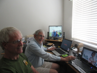
Billiard and Al Working on Computers
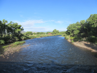
I spent one more night in Idaho. Since I was heading to Yellowstone, I did not want to arrive late in the day, for it would probably be very difficult to find an available campsite. So I stopped at Riverside Campground in the Targhee National Forest. It wasn't a campground that I would normally stay at for any length of time, but it was a place to sleep.
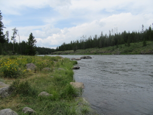
View Upstream along River at Riverside Campground
The next morning, I left Riverside and entered Yellowstone National Park.
July 9 - 15: Wyoming
Wildernet – Wyoming
State of Wyoming
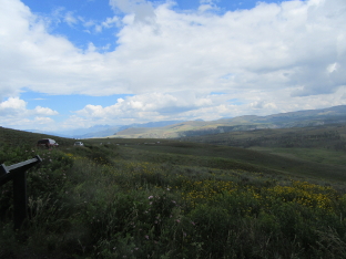
I actually entered the state of Wyoming inside Yellowstone, since a bit extends across the border. Upon arrival, I went as quickly as I could up to Indian Creek Campground and secured a site for a couple of nights. There weren't a lot of them left, even though it was still well before noon. This year was already proving to be the busiest ever for outdoor recreation that I had ever experienced.
Once I got my site set up I headed out to see the Park. I went south toward the Norris junction, then east over to Canyon Village, where I got a shower. Along the way, I stopped at several places to see the scenery and take pictures.
View along Road near Indian Creek Campground
Marshy Area and River Upstream from Virginia Cascades
After taking a shower, I found a nearby picnic area and had lunch.
Making Lunch at Cascade Lake Picnic Area
The previous two times I had been in Yellowstone (Rocky Mountain High '05 and Combination Trip 2010), the portion of the road along the east side of the north loop had been closed for construction. Now it was open, and I decided to go up that way and see Mt. Washburn and the region around it.
View from Washburn Hot Springs Overlook
Storm near Dunraven Pass
View North from Dunraven Pass
After Mt. Washburn, I continued along the north loop, stopping here and there to sightsee and take more pictures. Here is a view of Calcite Springs.
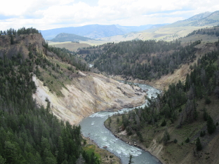
Calcite Springs from Overlook
After fighting the dreadful traffic near Mammoth Hot Springs—and stopping to get a T-shirt at the general store—I paid a visit to the Sheepeater Cliffs.
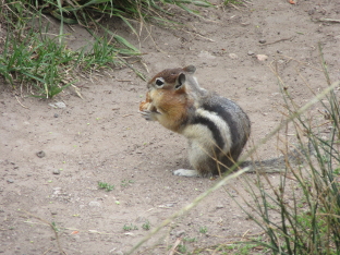
Chipmunk at Sheepeater Cliffs
Billiard at Sheepeater Cliffs
It was getting late in the afternoon, so I headed back to the campground, had supper, and then relaxed for the evening.
The next morning I decided to visit Mammoth Hot Springs before the 10,000 other tourists showed up to clog the streets and trails. It was a pleasant morning, and I wandered around the thermal basin, this time trying to take pictures that were “different” than the ones I had taken on previous visits.
Billiard in Front of Liberty Cap
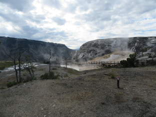
Mammoth Hot Springs with Gorge in Background
After leaving Mammoth Hot Springs, I stopped at a few places along the northern loop, and finally ended up at Roosevelt Lodge, where I started out on the Lost Lake Trail. I had done this trail during Rocky Mountain High '05, and again wanted to take some more—and different—pictures.
View of West End of Lost Lake
Green Hillisde above Trail by Lost Lake
As you can see in these pictures, what had started off as a fairly clear, blue sky had changed radically. I ended up trudging the entire second half of the trail in a downpour, unable to take any more pictures without risking damaging the camera. This was a “preview of coming attractions”, as this year, unfortunately, turned out to be the wettest trip I have ever taken.
I had planned on going up to the Petrified Tree to take a picture. Unfortunately, they were doing some kind of construction work and closed the trail, not even permitting visitors to climb up on foot. Fortunately, my camera has a fairly good zoom, so I was able to take this picture (the only one I risked in the rain).
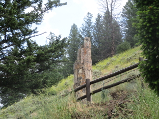
Petrified Tree from Parking Lot
Following lunch at a nearby picnic area, I stopped to visit a few more attractions along the way. I got some good pictures at Blacktail Lakes, but when I got to Wraith Falls, the waterfall was nowhere near as nice as it had been ten years earlier, so while it was a pleasant stroll, I did not end up with any decent pictures worth including there.
View of Blacktail Lakes
The next morning I moved camp, heading down to Lewis Lake Campground near the South Entrance. Before I left, the campground host at Indian Creek told me that Lewis Lake was the last campground to normally fill up, and even in busy season there were days when it never did. So I traveled down, stopping from time to time to take pictures, not worried about finding a site. When I arrived, however, it appeared that, incredibly as it may seem, the campground was already full, even earlier than Indian Creek! It turned out to be a false alarm; the campground host had quit the day before, and nobody had collected the expired reservation tags from the site posts. A park employee told me that if the departure date on the tag was the current date, then the site was really unoccupied and I could take it. I quickly found such a site and set up camp.
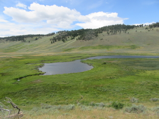
Lake and Hot Spring Seen in Morning Light
After setting up camp and having lunch, I did some more sightseeing that afternoon, on the west side of the south loop. Firehole lake Drive, Firehole Canyon Drive, Old Faithful, etc. Here are some pictures…
White Dome Geyser Erupting (Firehole Lake Drive)
This Buffalo Caused a Major Traffic Jam!
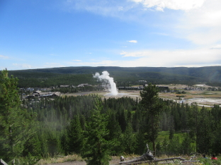
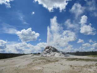
View of Old Faithful Erupting from Observation Point
Afterward, I returned to Lewis Lake to spend the night. But before I hit the sack I went down to the lake to take some pictures.
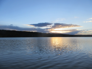
View of Sunset over Lewis Lake
I began the next morning by returning to the Natural Bridge. I had visited this attraction during Rocky Mountain High '05, and taken a few pictures. In the ten intervening years, the trail had not changed much, but the hillside below the Bridge had become more overgrown with trees. It was a pleasant morning walk.
Bay and Highway Bridge Seen from Natural Bridge Trail

Natural Bridge from Partway Up Final Trail
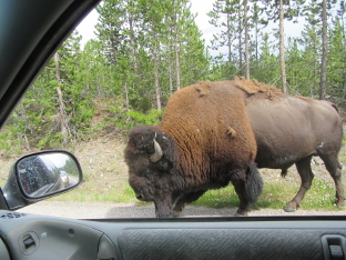
Driving around afterward, I ran into yet another buffalo messing with traffic!
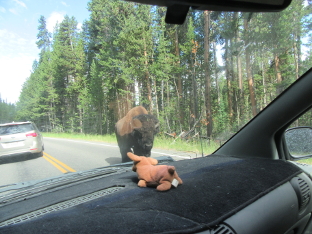
Buffalo and Car Mascot “Weenie Dog”
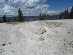
After leaving the buffalo to wander along the road, I visited the Mud Volcano area. The parking lot was absolutely jammed—I think it was around this time that I made my vow to never return to Yellowstone after the Fourth of July—and I noticed that the place where a thermal feature had broken through the asphalt was gone. Either the new feature died away, or they redesigned the parking lot. I never found out which.
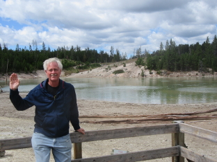
Billiard at Sour Lake in the Mud Volcano Area
After having a picnic lunch and taking some pictures around the picnic area, I headed over to the West Thumb Geyser Basin. Again, the parking lot was pretty much jammed and I had to really look in order to find a place for my car.
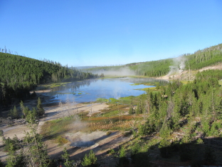
It was here that I learned directly that thermal areas are dynamic. Several of the pools that I had known from previous visits were dry as a bone. I actually wondered what was going on deep inside the Earth, if the changes were possibly leading up to an eventual eruption of the volcano. As I write this, it still has not exploded. I'm not terribly worried; it's in God's hands, and I trust Him!
This Pool (Perforated Pool) Used to be Full of Water
After visiting West Thumb, I headed back to Lewis Lake, spent the evening, slept, and the next morning left Yellowstone, heading south into Grand Teton National Park.
As during Combination Trip 2010, I did not spend the night in Grand Teton. However, I stopped several times along the way to see the sights and take some pictures. This time, I did not take the Jenny Lake Loop Road as I always did before, choosing to see some sights along the main road that I had missed on previous visits.
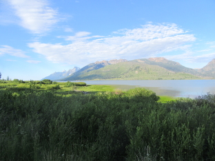
View Across North Arm of Jackson Lake
View of Christian Creek looking East from Bridge
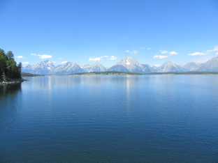
Tetons and Jackson Lake from Middle of Jackson Lake Dam
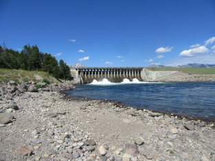
Jackson Lake Dam seen from Down River
When I left Grand Teton, I stopped in Jackson to do some shopping, access the Internet, and have lunch. Then I continued along US 191 to the turnoff to Boulder Lake Campground in the Bridger National Forest.
I had stayed in Boulder Lake once before, during Camping Trip 2000. That year, the road had been such a dreadful washboard that I honestly wondered if I would damage the car! This year, however, the road was in good condition. The campground hostess told me that the county was now maintaining it, and that it had been recently graded.
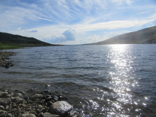
View of Boulder Lake looking West along its Length
I stayed two nights at Boulder Lake, then left, heading south to Rock Springs, where I shopped, had lunch and got on-line. I did not know it at the time, but this would be the last time I would ever access the Internet with my computer during this trip. Oblivious to what my computing future held, I went east, then south, then east again into the Medicine Bow National Forest to Lost Creek Campground, where I spent one night. I had spent the Fourth of July weekend here during Rocky Mountain High '05, and returned for a weekend during Combination Trip 2010, but this time it was just a place to sleep before heading down into Colorado.
July 16 - August 10: Colorado
Wildernet – Colorado
The Official Site of Colorado Tourism
The Official Site of Colorado Tourism
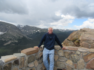
I had originally planned to stop at a campground near Rocky Mountain National Park, and then visit the park the next day. My reasoning was that it would take until at least noon or later to get to a campground, and the ones in the park were all quite expensive. However, when I looked at the map I realized that if I took State Hwy 125, it would cut at least a few hours off my trip, enabling me to arrive at the Park fairly early. I could then get a campsite for only one night, which would be cheaper than two nights at any of the nearby places that I had found. I simply had not noticed this highway before.
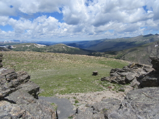
I got to the Park entrance around 10:00 in the morning, and was surprised to find all of the campgrounds except for one already full. Fortunately, this was the campground (Timber Creek) that I had wanted to stay at anyway, and when I got there, there were still a number of sites available. So I reserved a site for one night and then headed out to see the park.
From the west side through the main part of the Park, there is only one road. And it was crowded. I had not realized how popular this Park was. Every place I stopped, it was hard to find a parking place. And every trail teemed with tourists. Even the downpour that hit just after I left the highest part did not discourage the visitors. Fortunately, it stopped raining by the time I got to a picnic area to have lunch.
Here are some photos from the drive across the Park.
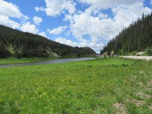
Poudre Lake at Milner Pass
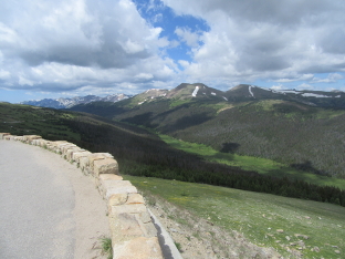
View from Medicine Bow Curve
View from Summit of Rock Cut
Billiard at Forest Canyon Overlook
It started raining just as I got someone to take the previous picture, and got harder as I drove down the east side of the mountains. Fortunately, it quit shortly before I got to the picnic area I was aiming for, and I was able to eat lunch. Afterward, I made my way to Bear Lake Road. There were a couple of nice lakes I wanted to see along it.
At the end of the road is Bear Lake itself. (I don't know how many lakes are named “Bear Lake”, but this was at least the second that I have been to just in the state of Colorado!) The only unfortunate thing was the sky; gray skies don't combine well with this location to make for great pictures. But I did hike around the lake and take some pictures, anyway.
Lengthwise View of Bear Lake
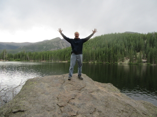
Billiard with Arms Raised at Bear Lake
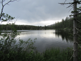
After leaving Bear Lake, I stopped and hiked the trail around Sprague Lake.
Sprague Lake with Mountains in Distance
After leaving Sprague Lake, I started back toward the west side of the park. Along the way, I stopped at several places that I had missed on the way over because of the rain.
View of Many Parks from Main Overlook
View from Rainbow Curve
View from Meadow Bow Curve
Finally, I got back to Timber Creek, where I spent the night. The next morning I left the Park, and began a time of simply camping out in national forests and relaxing, with the occasional hike for fun.
I had originally planned to stay at a dispersed campground in the Routt National Forest, but when I got there, I was not impressed with the forest. Nor could I find sites or even an outhouse. So instead, I made my way over to the town of Eagle, and then up to Yeoman Park Campground in the White River National Forest, a place that I had been to before during Combination Trip 2010, and therefore knew was a good campground.
I was surprised to find the place so full. Fortunately, there were a couple of sites left and I got one. I had sensed during my travels that this year was a very busy year for outdoor recreation sites, and this only confirmed it. So at that point I made the decision to never arrive at a new campground on Friday or the weekend (it was Friday when I arrived at Yeoman Park). By following that rule, I did not have any unpleasant surprises during the rest of my trip.
View of Valley from Yeoman Park Campground
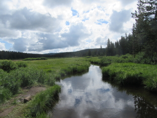
While at Yeoman Park, I hiked the Brown's Loop Trail, a walk of a couple of miles that goes up the valley and returns along the edge of the forest. I had hiked this same trail five years earlier, but going the other direction.
Still Pond by Brown's Loop Trail
I had taken a picture of this same pond in 2010, and liked it so much that I used it for my computer desktop wallpaper until I replaced it with the one mentioned above from Jasper Park in Alberta.
On Monday, I left Yeoman Park, intending to go to another campground further south in the Rio Grande National Forest. Along the way, I stopped in Avon, a small tourist town just off I-70, shortly before the exit for US 24. I went to WalMart to stock up, and then to McDonalds to use their public wireless (while sipping a milkshake; I don't use their services without buying something). When I turned my computer on, it took longer than usual to boot, and then presented a text console that I recognized as being a symptom of boot failure. I tried again, but got the same result. Not good. I tried the verbose mode and found that the hard drive had developed errors.
This was not good. But unfortunately, there wasn't anything I could do about it at the time. So I continued on my way south and finally came to Storm King Campground, where I spent the next three nights. While there I tried a few things with the computer, but nothing worked. Fortunately, I had done a complete backup of the hard drive before leaving Idaho, and the only thing I had added afterward was a few pictures—which I still had on the camera. And I had downloaded some email messages, copies of which were still on the server. So I had not lost any data.
Campsite at Storm King Campground while Cooking Dinner
When I left Storm King, I planned to go to another campground in the same Forest. But first, I stopped in Alamosa, where they had a WalMart and, I was told, a computer shop that might have some utilities that I needed (and will make sure I have with me during future trips!). I had been to the WalMart before, but the computer shop was a bust. They probably had what I wanted, but the people were extremely uncooperative. In the end, I went to the city library and used a public computer in order to catch up on email. This was the first of several times that I did this before getting to Tucson.
Afterward, I went to Rock Creek Campground, a place I had visited before during Rocky Mountain High '05. I found the campground pretty much unchanged, but the weather was notably worse this time. I was beginning to realize that this was going to turn out to be the wettest trip I had ever made.
Furthermore, when it did clear up and warm up a bit, the flies came out. Not one or two. Not a half-dozen. I'm talking flies. Like a Biblical plague of them. If I stood in one place, I would be surrounded by 40-50 of the things. I'm not exaggerating. I had never seen anything like it. I ended up putting my deck chair inside the tent during the day in order to be able to sit and relax without having flies crawling over my entire body.
Site at Rock Creek seen from near Creek
When I left Rock Creek, I swung through Alamosa again, stocking up on a few items at WalMart, doing laundry, and going to the public library again. While in Alamosa, I also discovered a supermarket chain called City Market, which has reasonable prices and, even more important to me, block ice. It is increasingly hard to find blocks these days, and they last a lot longer than cubes. So I was very grateful to find this chain, and began looking for them while traveling, so that I could get ice blocks for my cooler.
After leaving Alamosa, I went west and then north to Cathedral Campground, also in the Rio Grande Forest. This was another old friend from both Rocky Mountain High '05 and Combination Trip 2010. Fortunately, the rain let up some while I was there, and there were far fewer flies. Overall, it was a very pleasant three nights that I spent at Cathedral.
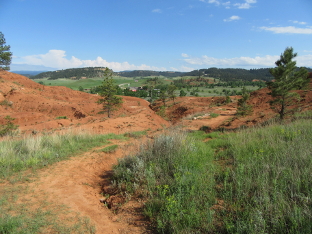
While at Cathedral, I went up to the Fremont's Camp Trail and hiked up a ways.
View of Valley from Fremont's Camp Trail
I left Cathedral on Thursday, intending to go to Deer Lakes in the Gunnison National Forest. On my way, I crossed the Rio Grande (river, not forest!) and took a few pictures.
Rio Grande looking Upstream from Bridge on County Road 18
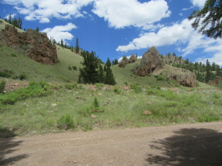
On the way, I passed through Creede, a small town on State Hwy 149. While there I got a shower and Internet access, then continued to the turn off at Slumgullion Pass that leads to Deer Lakes and some other campgrounds. By the time I got to the Pass, I was already seriously concerned. On Hwy 149, I traveled through large stretches of forest that was mostly dead, a result of a plague of beetles that has been killing spruce trees for the past several years. And when I got to Deer Lakes—one of my favorite stops—my fears were realized. The campground had been all but destroyed. Yes, it still existed. Yes, the lakes were still there. But the forest was practically gone, except for a few small aspen (which are not affected by these beetles). Saddened, I continued down the road until I got to Spruce Campground, where the beetle damage had not yet reached the point where the trees were dying.
View of Surrounding Countryside from Site at Spruce Campground
The day I arrived at Spruce, it looked pretty good. The weather was decent, and although there were more flies than at Cathedral, there weren't nearly as many as at Rock Creek. I was beginning to breathe easier with respect to flies. However, the weather got progressively worse the next three days, until it literally rained all day. I could not get out and explore the area. I finally left on Monday and went through Lake City, stopping only to pick up some items at the local supermarket, before going out to Big Blue Campground in the Uncompahgre National Forest.
I had been to Big Blue during Rocky Mountain High '05 and enjoyed my stay. It is not a heavily used campground, and when I got there, only a few sites were occupied, and the one I had 10 years ago—and my favorite—was still available.
View out Exit from Big Blue Campground
During my stay at Big Blue, the rain decided to (mostly) take a little vacation, and I had a pleasant three days. In addition to the campground itself, Big Blue is on the side of a green valley with a stream running through the middle. A lot of people come there to fish, and from what I saw, there are plenty of fish to be caught!
Looking Up Big Blue Valley
Big Blue Creek in Valley Looking Upstream
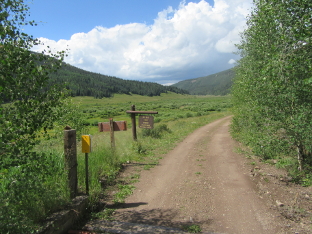
Before I left, I talked to a fellow camper who told me that the back road leading up to US 50—which turns off about halfway up the road to Big Blue—was in good condition and did not require 4-wheel drive or high clearance. So when I left, I was able to take a short cut and save a number of miles, as well as drive through some more scenic territory. After stopping in Montrose for shopping, laundry and a public library, I went on down to Thistledown Campground, also in the Uncompahgre Forest. The access road is just south of Ouray, off US 550.
I had originally planned to go to Angel Creek Campground, only about a mile away, with Thistledown as a backup option. However, the road to Angel Creek was not clearly marked, and I found myself at Thistledown before I knew it. I asked the campground hostess, and she told me how to get to Angel Creek, but also remarked that the road was in terrible shape and questionable for my vehicle. Since there was a site available at Thistledown, I took it.
Entrance to Thistledown Campground from County Road 361
This turned out to be a surprisingly pleasant campground. I stayed four nights, and only had one rainy day. On the last day I hiked up the road to the access road to Yankee Boy Basin. It was a considerably longer distance than I had been told. Nevertheless, I did manage to get some good pictures along the way.
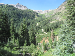
County Road 361 seen from Yankee Boy Access Road
Valley and Peaks from Yankee Boy Access Road
Mountainside near Top of Yankee Boy Access Road
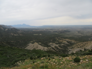
I was nearly done visiting Colorado. Only one more stop remained on my itinerary. So after shopping and Internet in Durango, I went on to Mesa Verde National Park.
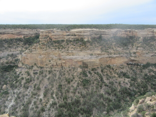
Mesa Verde is not a typical outdoor recreation park. Rather, it is a historical park. Its main purpose is to preserve and make available to the public the ancient cliff dwellings of Native Americans who lived in the region. Additionally, there are a number of scenic overlooks along the main Park road. There is only one campground, and it is not cheap. But showers are included at no extra cost. And there is an excellent pancake buffet served at a restaurant for a very reasonable cost!
Since I arrived after noon, it wasn't long before the afternoon thunderstorms rolled in, and some of my views from the overlooks were rather dampened. Nevertheless, I did get some shots.
View from Montezuma Valley Overlook
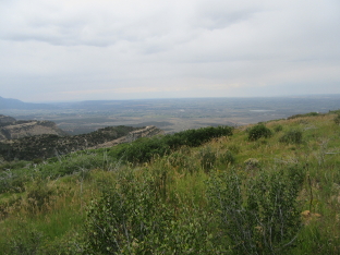
View from Park Point Overlook (Highest Point in Park)
At the end of the road, there is a museum, plus a couple of loop roads where you can stop and see the cliff dwellings from overlooks. There are also guided tours, but I was only there for one afternoon, so I did not bother. (The advantage of the guided tours are that you get to see inside some of the places that are closed to casual visitors. But like so many first visits to parks, this was largely an overview visit.) I drove both the Cliff Palace Loop and the Mesa Top Loop, stopping along the way to see the historical attractions.
House of Many Windows (Middle-Top of Cliff)
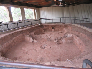
Ancient Pit House Preserved in Shelter
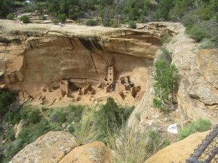
Square Tower House on Side of Canyon
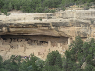
Group Taking Guided Tour across Valley
After finishing my visit to these sites, I returned along the main Park road to the campground, where I spent my last night in Colorado before driving through the northwest corner of New Mexico and on into Arizona.
August 11 - 15: Arizona
Wildernet – Arizona
Arizona Highways
Arriving in Arizona, I gained an hour, since except in some of the reservations, Arizona does not use Daylight Savings Time. In a way, that is sort of unfortunate, since DST allows me to make better use of evenings while out camping. Nevertheless, the extra hour made it easy to arrive at Big Lake in the Apache National Forest in plenty of time to find a site. As I found out after I got there, after the first week in August, the campground rarely fills, at least during the week, because school has started again and families end their vacations and stay home.
As I neared Big Lake, I found myself driving through stretches of forest that had been burned to cinders, leaving nothing except blackened stumps in place of trees. I found out that there had been a major fire in 2011, only a few months after I returned to Brazil that year. While at the Rainbow Campground at Big Lake, I hiked the Indian Springs Trail, which is a 7.5 mile loop with a side trail connecting to the campground. Most of this trail passed through burned forest, and as a result, while it was exercise, it was not as enjoyable as it could have been.
Sunset over Big Lake
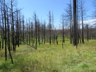
Burned Forest along the Indian Springs Trail
After spending two days at Big Lake, I took the back road over to Alpine. Ever since I first began taking camping trips, this has always been a gravel road. Well-maintained, for the most part, but gravel. I still remember shredding a tire on this road during a short trip back in the '80s. However, the road is now paved. I guess that goes to show that not all change is for the worse; because I did not have to devote so much attention to the road, I was able to enjoy the scenery around me more than ever before.
At Alpine, I picked up US 191 and headed south for KP Cienega Campground. Here I got the worst shock of the entire trip. In past years, fires had spared the KP area. But not this time. While they saved the campground itself, everything that made it a place I loved to visit was gone. Destroyed. It hit me even harder than Deer Lakes back in Colorado, and left me seriously wondering how many more places I've known and loved are going to be destroyed.
In the end, I went back a few miles and stayed at Hannagan Campground, near the tiny community of Hannagan Meadow. This is a campground that I had passed many times, even gone in and looked at a couple of times (and got water, after they closed down the water at KP Cienega). Fortunately, the fire had spared Hannagan to a considerably greater degree than it had spared KP, and I was able to find a good site for my last two nights camping.
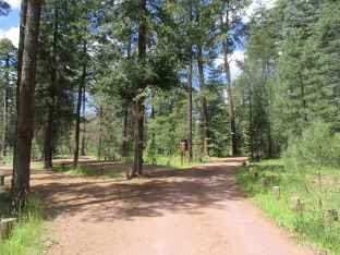
Main Loop of Hannagan Campground
While at Hannagan, I took a hike on a nearby trail. There is a connection trail that begins in the campground itself. There were a couple of destinations listed on the signpost, and the distance was only a couple of miles. Unfortunately, these trails pass through burned forest, and the Forest Service has not been maintaining them since the fire. I managed to get fairly close to the first destination, when the trail simply vanished. I spent several minutes looking around for where it continued, but was unable to find anything. I was not surprised; the trail had been getting more and more difficult to find as I approached that section. So I was forced to turn back; the alternative was getting lost in the woods.
Saturday, the 15th arrived. This was the day that I had told friends in Tucson to expect me. In addition, I had timed things so that I ran out of meat and most of my other food stock at the same time. So here I was, expected in town, and with nothing left to eat. It was time to return to civilization.